|
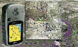
TRAIL FILES (Download Maps) Below are various file formats of the
trails. The most common is GPX (the GPS Exchange Format) from
TopoGrafix.
Learn more about GPX
format at here.
GPX (the GPS Exchange Format) is a XML data format for the
interchange of GPS data (waypoints, routes, and tracks) between
applications and Web services on the Internet. Use the tools
found on the Tools page, you can upload them to various GPS
navigators.
Keyhole is great imagining/flythrough software now picked up
by Google as their satellite/aerial tool. KML is in XML format.
Here is a simplified map for printing. You'll need
Acrobat Reader to view.
As the collection of maps grows they will be added below.
Please stay tuned and HAPPY TRAILS!...
|
FILE |
Description |
download |
where |
| Barton Creek Greenbelt -
Southwest |
Austin Greenbelt, west of
360 |
[GPX
| KML
| PDF
] |
map it |
| Reimer's Ranch - Easy |
Well-groomed trails for
all levels |
[GPX
| KML | PDF
] |
map it |
| Emma Long - Main |
Share with the Engine
Bikes |
[GPX
| KML | PDF ] |
map it |
| Muleshoe Bend |
Took this w/ a MTB class.
FUN |
[GPX
| KML | PDF ] |
map it |
| |
|
|
|
|