|
LINKS I'm always on the look out for new software to
help create web pages out of eTrex data. Here are some links
that have helped.
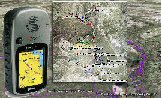
- www.topofusion.com
- provides the pictures along the ride. Great visualization
tool for trails but uses USGS 10-year old satellite imagery
for it's background. Also, has a great 3D tool.
- www.expertgps.com
- the best software for managing waypoints and tracks. It
also pulls data down from USGS site so the imagery is old.
- www.motionbased.com
- where riders can post their trails and review/share
profile data. I'm the first from
Texas to post, I believe. You can export directly into a
Keyhole KML file instead of having to transform the data
using XSLT.
-
http://360cycleworks.com/site/intro.cfm - where to buy a
good MTB here in Austin
- http://www.keyhole.com
- I finally found some good aerial photography w/ good
resolution. Google is now using Keyhole for their imaging
software.
-
http://www.singletracks.com/ - Another good trail log
for MTB riders. The link points to some published pictures
of ridden trails.
Mike's Trails in CA
My brother-in-law lives in CA. Here are some of his trails
posted to MotionBased.com:
|